How an app is making the prairies safer for pronghorn
Do you have an idea to help nature and wildlife in your community? Submit your idea by Nov. 12 and you could receive a Go Wild Community Grant, presented by TELUS, up to $7,000 to bring it to life.
Canada’s prairies are a wide-open place where the buffalo roam and antelope play. Right?
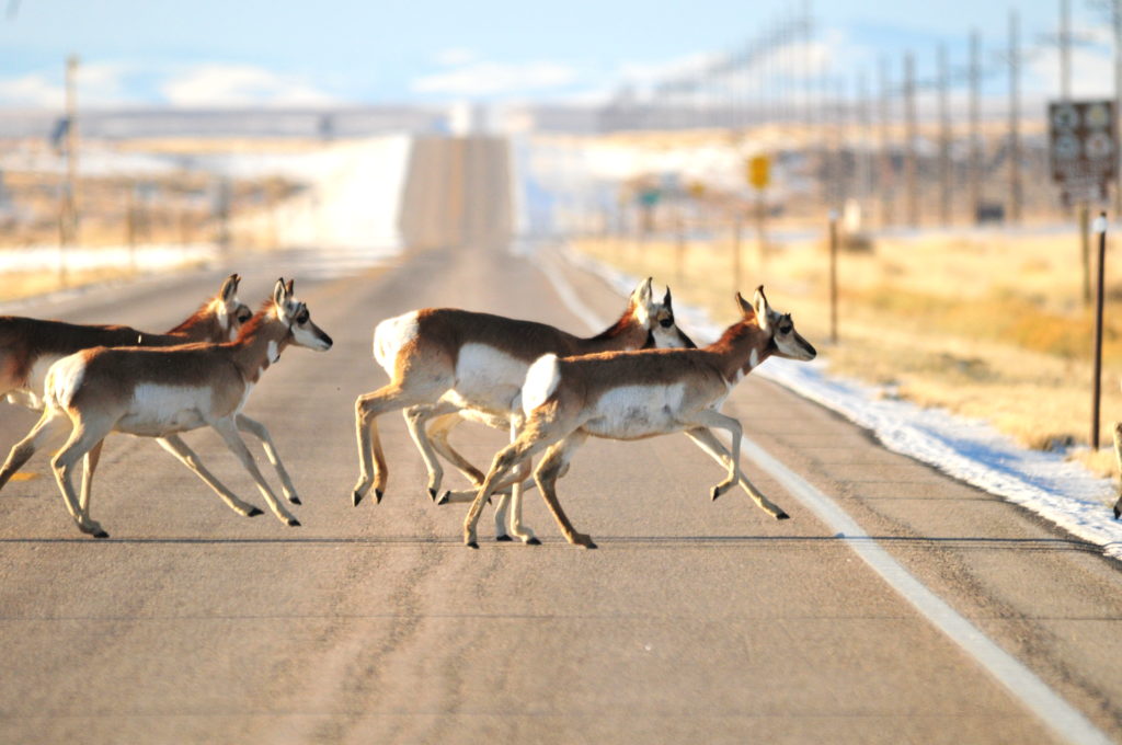
Pronghorn, often called antelope (although they’re not closely related,) roam the plains of Alberta, Saskatchewan and into the United States. And they do so at incredible speeds of up to 90 kilometres per hour, making them the fastest animal over long distances. However, the landscapes they travel are highly fragmented, putting the survival of this unique species at risk.
With support from a WWF Go Wild Community Grant, presented by TELUS, the Miistakis Institute developed a citizen science app, Pronghorn Xing (crossing), to help make roadways safer for wildlife.
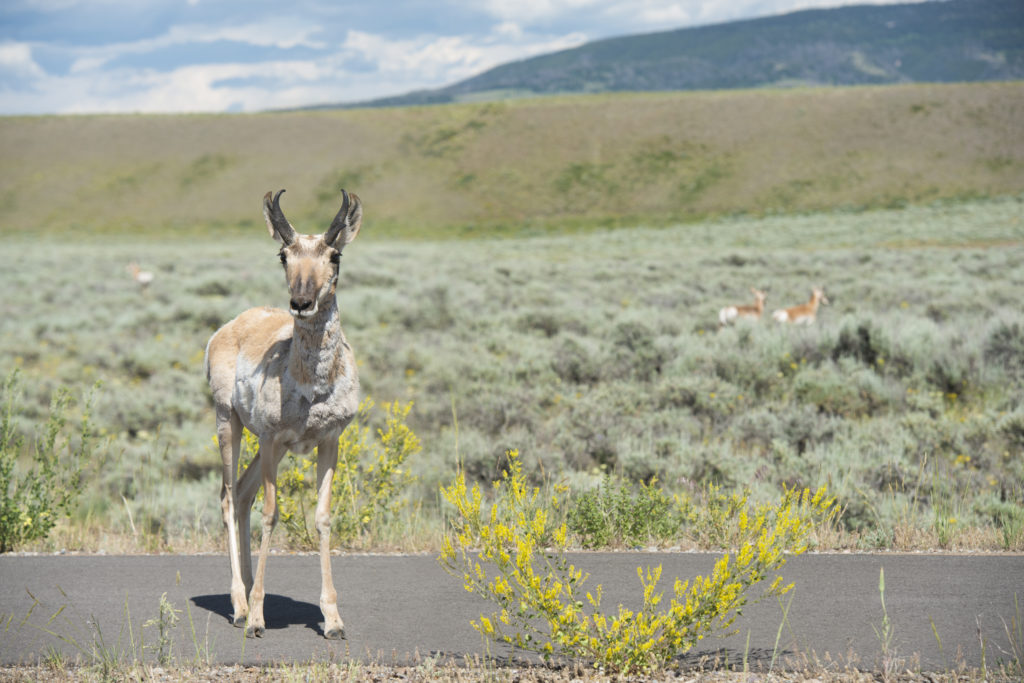
In Alberta and Saskatchewan, pronghorns are at the northernmost point of their range. Large herds cross the grasslands, following the same seasonal migration routes year after year, generation after generation, journeying as far as 800 kilometres from their summer range to less snowy areas in the winter months and back again. This spectacle is one of the last remaining large mammal migrations in North America.
Today, busy highways disrupt those historical migration routes and can lead to vehicle collisions and fatalities. Pronghorn Xing app users have reported pronghorns running back and forth along roadside ditches watching for an opportunity to cross before darting in front of traffic, a dangerous situation for both wildlife and drivers. They can also become trapped by fences.
“We know there is an issue with their migration route. There’s also a lack of data on where those seasonal pinch points are that are a barrier to pronghorn movement,” says Megan Jenson, program co-ordinator for Pronghorn Xing. “It could be an area on the highway that is particularly busy, or some fences where the barbed wire is too low on the bottom for them to go under. We’re not sure and that’s one of the things we’re trying to figure out.”
The Pronghorn Xing app crowd sources information about the routes drivers are taking and the wildlife they spot along the way, pronghorn and otherwise. People can also submit other helpful observations such as whether the animal was crossing the road, at the side of the road or if it had been hit.
The data, which is being collected over the course of three years, will be submitted to government organizations in Alberta and Saskatchewan to help inform mitigation strategies such as wildlife overpasses (pronghorn exhibit a clear preference for overpasses to underpasses) and wildlife-friendly fencing.
Wildlife crossings have been very successful in keeping animals and drivers safer in places such as Banff in Canada and in the United States in Yellowstone National Park and Wyoming, where wildlife-vehicle collisions have been reduced by 81 per cent and pronghorn-vehicle collisions eliminated altogether.
The app also enables the public to participate in pronghorn conservation. “Citizen science creates an awareness that this iconic prairie species is facing a problem and that they can be part of the solution,” says Jenson.
Apply for a Go Wild grant
If you’re feeling inspired, submit your idea by Nov. 12 to help protect nature. You could be granted up to $7,000 to bring your project to life. By harnessing the conservation power of people like you, we can help prevent – and even reverse – the decline of wildlife.